Mt. Lewotobi Laki-laki: A Day of Eruptions Unveiled
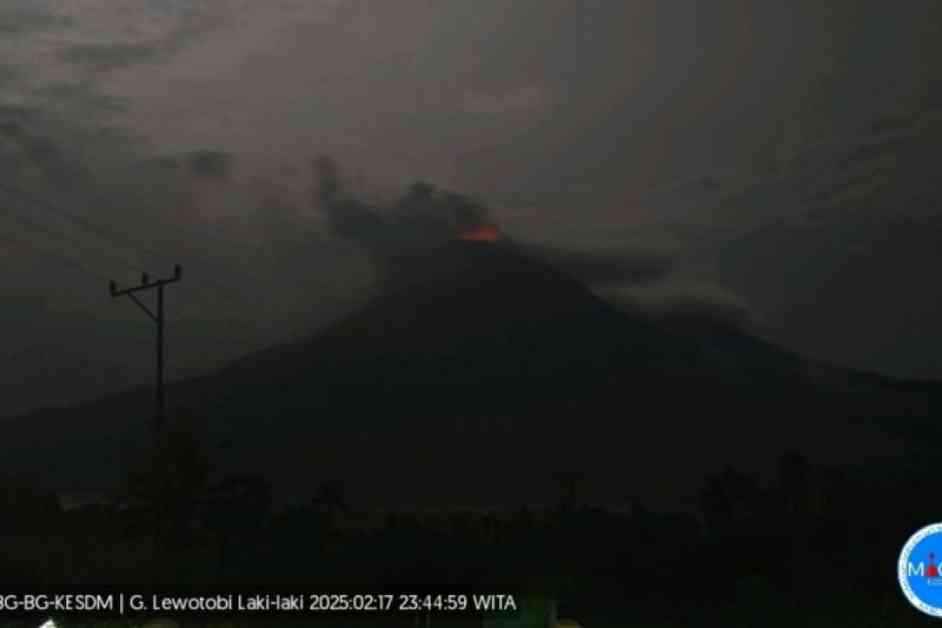
Mount Lewotobi Laki-laki, nestled in the East Flores District of East Nusa Tenggara (NTT), made headlines on Monday with a series of three significant eruptions. The Center for Volcanology and Geological Disaster Mitigation (PVMBG) of the Geological Agency reported these explosive events occurring at 15:58, 16:22, and 23:43 local time, capturing the attention of residents and experts alike.
The initial eruption, a breathtaking display of nature’s power, sent an ash column soaring 900 meters above the peak or approximately 2,484 meters above sea level. The ash, a dense gray hue, billowed towards the northeast, painting the sky with a dramatic backdrop. Seismographic recordings revealed a maximum amplitude of 14.5 mm, marking the eruption’s intensity, which lasted for a gripping one minute and 42 seconds.
As the day unfolded, the second eruption followed suit, with an ash column rising 500 meters above the peak or about 2,084 meters above sea level. The ash plume, a continuation of the day’s volcanic symphony, drifted north and northeast, adding to the awe-inspiring spectacle. Seismographic evidence captured a maximum amplitude of 5.9 mm, encapsulating the eruption’s magnitude, lasting for a captivating one minute and 18 seconds.
The third eruption, a crescendo to the day’s volcanic trilogy, showcased an ash column reaching 400 meters above the peak or around 1,984 meters above sea level. The ash, resembling a dense gray veil, cascaded towards the north and northeast, completing the visual narrative of Mount Lewotobi Laki-laki’s fiery dance. Seismographic data registered a maximum amplitude of 3.7 mm, underscoring the eruption’s impact, concluding with a duration of approximately 50 seconds.
Amidst these natural wonders, Mount Lewotobi Laki-laki now stands at Status Level IV (Alert), prompting authorities to enforce a six-kilometer exclusion zone around the eruption center and extending to seven kilometers in the Southwest-North-Northeast sector. This precautionary measure aims to ensure the safety of the community and visitors, urging them to steer clear of the volcano’s potential hazards.
Residents residing near Mount Lewotobi Laki-laki are urged to remain vigilant, particularly during periods of heavy rainfall, as lava floods may pose a threat to areas downstream from the volcano. Local authorities advise residents to stay informed through official channels, disregarding unverified sources, and follow safety protocols to navigate the potential risks associated with volcanic activity.
In the wake of the eruptions, the government has taken swift action to allocate 20 hectares for refugees affected by the volcanic events, demonstrating a commitment to supporting those impacted by the natural disaster. Additionally, amidst the challenges posed by the eruption, regional elections in disaster-affected regions have proceeded smoothly, showcasing resilience and adaptability in the face of adversity.
As the volcanic landscape continues to evolve, the stories of Mount Lewotobi Laki-laki’s eruptions serve as a reminder of nature’s raw power and the importance of preparedness and community support in navigating these unpredictable events. Let us remain vigilant, united, and resilient in the face of nature’s breathtaking displays, finding strength in our shared humanity and unwavering spirit.
Translator: Gecio Viana, Resinta Sulistiyandari
Editor: Azis Kurmala
Copyright © ANTARA 2025


